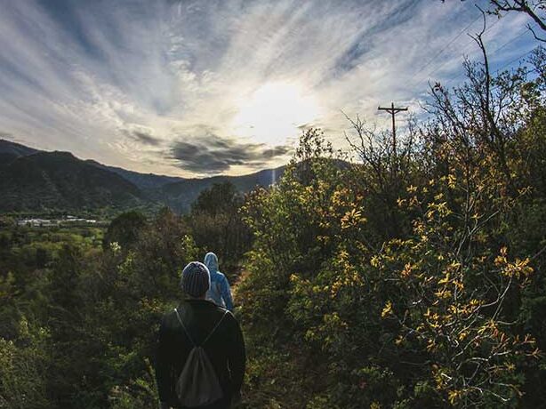
Hike the Mid State Trail
Running through Buchanan State Forest, and just 3/4 miles from River Mountain, is Pennsylvania’s Trail of the Year — The Mid-State Trail. The trail stretches 327 miles from Maryland to the New York border, crossing through the heart of Pennsylvania with some of the most scenic views overlooking Black Valley.
The Mid-State Trail is known as Pennsylvania’s wildest trail. Wild means that the trail is less maintained than what you might expect. There are areas where the trail can be overgrown, down trees, and creek crossings. While the trail is marked, it can be confusing and you need to have a map or have downloaded the Alltrails app. There is no cell service. Please read our checklist below before starting your hike.
Hike Smart Checklist:
• Hikes range from moderate to difficult due to elevation change and distance.
• We highly recommend doing an out and back so you do not get lost and can turn back if you need to.
• Check-in with us before you leave and when you return from your hike.
• It is best to hike with another person or group.
• Bring plenty of water and a snack.
• Wear and bring bugspray.
• We recommend wearing pants to protect your legs from scratches and bugs.
• There are ticks in the outdoors. Check for ticks as you hike and upon return.
• There is little to no cell service on the hiking trails.
• Take a map, photo of the map, and download the Alltrails map on your phone.
• FYI! The Mid-State Trail is also labeled as “Garlic Trail” on trail signs and maps.
• Buchanan State Forest has many trails but very few are well-marked or well-maintained. You can easily get lost if you choose a different trail. We recommend you stick to these trails.
• There are timber rattlesnakes in Buchanan State Forest. Be listening and watching as you hike. If you encounter one, distance yourself and wait for it to pass.
• Stay on the trails.
• Leave no trace.
HIKE #1
TRAIL: Garlic Trail, AKA Mid-State Trail
HIGHLIGHTS: Closest + Easiest to Get To
DISTANCE: Out and Back, Up to You
OVERVIEW: Begins with a gradual, long uphill along the creek. Scenic as you hike along the creek up into Buchanan State Forest. Out and back means you’ll enjoy a gradual downhill on your way back to the car. Since this hike is along the creek, it can be very buggy on hot and humid summer days.
DIRECTIONS TO TRAILHEAD: Take a right out of the River Mountain driveway. When the road splits, stay left, to head toward Rainsburg on Hwy 326. Drive 1.12 miles and the small parking area will be on your left. There is a small trailhead sign for Garlic Trail. The parking lot can fit about 4-5 cars. Trail is marked with orange/reddish blazes.
Google Maps Link to Trailhead Parking
Apple Maps Link to Trailhead Parking
TRAIL MAP: Please view the Alltrails map below. Download the Alltrails app and the trail map using the link below. There is no cell service, download the Alltrails app AND map before you leave.
HIKE #2
TRAIL: Mid-State Trail
HIGHLIGHTS: Large Parking Lot for Groups – Higher Elevation, Less Humid + Buggy in Hot Summer Months
DISTANCE: Out and Back, Up to You
OVERVIEW: Access to the Mid-State Trail from this parking lot follows two, short grassy forest roads for about .25 miles. Once on the Mid-State Trail this route has a gradual uphill on your way out. On your way back, you’ll enjoy the very slight downhill. Higher in elevation and with no creek along this section of the trail, meaning there are fewer mosquitos, particularly during the hot, humid summer months.
DIRECTIONS TO TRAILHEAD: Take a right out of the River Mountain driveway. When the road splits, stay left, to head toward Rainsburg on Hwy 326. Drive 2 miles up to the top of the mountain. The large, gravel parking lot will be on your right. Park the car. At the Northeast side of the parking lot, you will see a dirt/grass forest road/path. Walk along that forest road for about 200 yards until you see a yellow gate on your right. Go under the yellow gate and follow the grassy path for about 400 yards. Watch for the orange/reddish blazes and the Mid-State Trail on your left. The grassy path intersects with the Mid-State Trail. Take a left to go uphill and follow the Mid-State Trail north for as long as you’d like. The Mid-State Trail is marked with orange/reddish blazes.
Google Maps Link to Trailhead Parking
Apple Maps Link to Trailhead Parking
TRAIL MAP: Please view the Alltrails map below. Download the Alltrails app and the trail map using the link below. There is no cell service, download the Alltrails app AND map before you leave.
